Thermal imaging surveys (often known as “thermographic surveys”) have become a game changer in assessing building standards, particularly for residential properties and businesses with commercial or industrial properties. Thermal imaging surveys traditionally use handheld thermal cameras, but in recent years have advanced with the evolution of drone technology with thermal drone surveys, which can offer a much more in-depth and detailed survey. Thermal imaging surveys provide us with valuable insight that is invisible to the naked eye, creating a digital image which displays the distribution of heat in a targeted area.
In this article, we’ll explore everything you need to know about thermal imaging surveys, including how they work, their diverse uses, and the benefits they offer!
What Is Thermal Imaging?
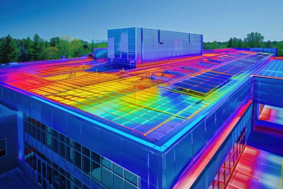
Thermal imaging involves a process where heat signatures are detected and visualised, using thermal cameras; every object emits some level of infrared radiation, and the intensity of that radiation increases with temperature. These heat signatures are detected through the infrared band of the electromagnetic spectrum, causing the colour variations that are seen in images produced by thermal cameras - warmer areas appear in bright colours (such as red, orange, or yellow), and cooler areas are shown in darker colours (like blue or purple).

Where Are Thermal Imaging Surveys Used?
Thermal imaging surveys are widely used for many different purposes, with some of the most common applications including:
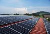
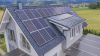
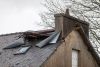
- Building and structural inspections, such as on roofs and solar panels
- Electrical inspections, identifying faults and overheating
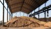
- Agricultural and environmental monitoring
- Search and rescue operations and emergency response
- Ensuring insulation has been installed correctly
- Wildlife surveys and conservation
- Security and surveillance
What Are the Benefits of Thermographic Surveys?
The use of thermal imaging provides several benefits for businesses and homeowners, such as:
- Early Detection of Issues: Hidden issues, such as air leakage, thermal bridging, or missing insulation, can be detected through anomalies in heat signatures before they become more serious and costly.
- Non-Invasive and Contactless: Thermal imaging surveys do not require physical contact with the objects being inspected, making them ideal for hazardous or hard-to-reach areas such as high-voltage electrical systems.
- Real-Time Analysis and Reporting: Thermographic cameras provide instant thermal images, allowing for accurate, real-time assessment of heat anomalies and quick decision-making.
- Improved Efficiency: Thermographic surveys are quick to perform, covering large areas in a short time. This technology can also work effectively in darkness, smoke, or fog.
- Cost Savings: By detecting areas of heat loss in a property, businesses and homeowners can target improvements to make such as sealing air leaks, saving on energy bills and improving energy efficiency.
Why Choose a Thermal Drone Over a Handheld Thermal Camera?
Thermal drones offer distinct advantages over handheld thermal cameras, particularly in terms of efficiency, coverage, and safety; it is no surprise that more people are making the shift to thermal imaging drone surveys. Some of these advantages include:
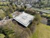
- Greater Coverage: Drones can cover areas much faster than a standard handheld thermal camera, making them ideal for covering large commercial properties, tall structures, or buildings with multiple floors.
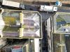
- Accessing the Unaccessible: Drones can easily fly over dangerous or inaccessible locations, such as high rooftops, industrial facilities, or rugged terrains, without risking the safety of surveyors - no need for scaffolding!
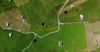
- Aerial Perspective, Improved Visualisation: The aerial view provided by a drone allows for a bird’s-eye perspective, enabling operators to capture thermal anomalies that would be difficult or impossible to detect from the ground.
- Consistent and Accurate Data Collection: Drones can be programmed to follow precise flight paths and maintain consistent heights, ensuring that thermal data is collected uniformly across the survey area.

How Do Drones Conduct Thermal Surveys?
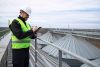
There are several steps that drone operators such as ourselves take when tasked with conducting a thermal survey on your property. Typically, we follow these 5 key steps to ensure a quick, straightforward process, getting you your results as soon as possible.
- Preparation and Planning: Our surveyors define the target area and establish a flight plan using software to ensure the best coverage, whilst considering factors like weather and obstacles.
- Deploying the Drone: The drone, equipped with a thermal camera, is launched to autonomously follow the pre-programmed flight path, ensuring consistent data collection.
- Thermal Data Collection: As the drone flies, the thermal camera captures infrared radiation, creating thermal images where warmer areas are highlighted in bright colours and cooler areas appear darker.
- Data Processing and Analysis: After the survey, the thermal data is downloaded and processed with specialised software, generating detailed thermograms, and simple, concise reports that highlight key findings.
- Delivery of Results: Findings from the survey are delivered to you in as little as 72 hours, meaning you can take swift action if any issues are present!
How Much Does a Thermal Drone Survey Cost?
The price of a thermographic survey using a drone depends on several factors. For example, the geographical location and size of the property being inspected will impact the price considerably; small properties with straightforward reporting needs will be cheaper, compared to large industrial sites.
For the most accurate pricing, please contact us to discuss your needs.
How Often Should I Get a Thermal Imaging Survey?
There is no “one size fits all” answer to how often you need a thermal imaging survey - it largely depends on the business type, the age of the property, and how recently you received a refurbishment. It is advised for surveys to be conducted before and after any exterior maintenance, or following any significant events such as storms or fires. If no major events have occurred, the general guideline is an annual inspection.
Choose Full View for Quality Thermal Drone Surveys
Thermal imaging surveys are important for any residential, commercial, or industrial property, and through the use of drones, they have become much easier and more accurate.
At Full View, we offer a service that is fast, accurate, and above all, honest; since we do not offer a repair service, we have no vested interest in finding damage that doesn’t exist! For any queries, please get in touch with us and we’ll do our best to answer them.