


How Our Drone Mapping Services Work
Our Commercial Drones - Spec’s and Capabilities
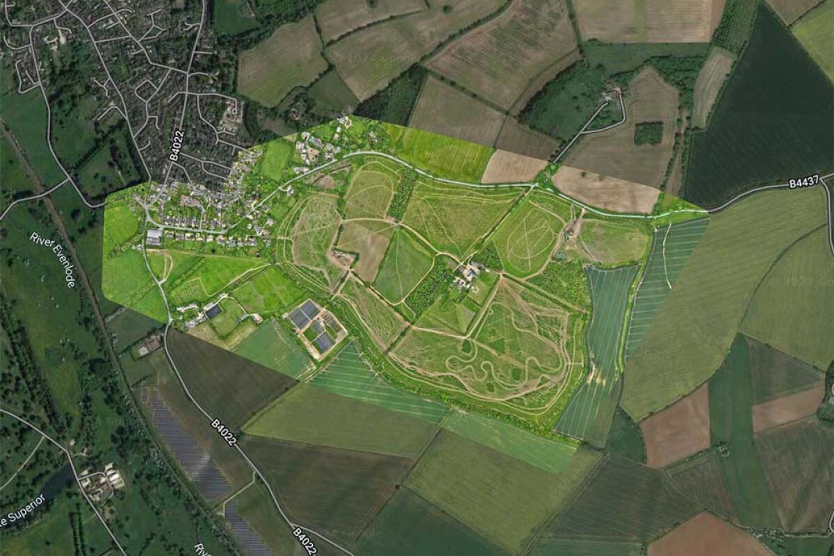
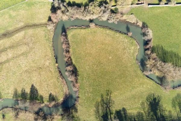
We process and analyse the data from our drone mapping aerial imagery to create accurate and usable maps in a variety of file formats, depending on your needs.
We work with high-quality, industry-standard commercial drones, equipped with high-definition cameras and technology that includes:
-
![Check icon]()
4K High-definition cameras.
-
![Check icon]()
56x Zoom capabilities that offer intricate levels of detail over huge areas of land.
-
![Check icon]()
Thermal imaging capabilities that can capture detail invisible to the naked eye.
-
![Check icon]()
Intelligent low-light mode capabilities that allow us to provide detailed imagery in sub-optimal conditions.
We process and analyse the data from our drone mapping aerial imagery to create accurate maps in a variety of file formats, tailored to your needs.
Industries We Offer Drone Mapping Services
Insurance
Agriculture
Construction
Landfill and Waste
Property Management
Renewable Energy (Solar + Wind)
Oil & Gas
Electric Power (power line monitoring)
Mining
Environmental
Disaster Management
Engineering
Drone Mapping Applications
Land Surveys
Construction Monitoring and Progress Tracking
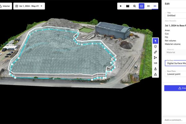
Stockpile and Inventory Management

Aerial Drone Mapping
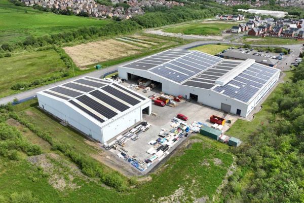
Asset and Property Inspections
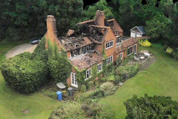
Insurance and Claims Assessment
Our Clients
![]()


![]()


![]()
Fast Data Collection
Aerial drone mapping can be completed much faster than traditional ground-based surveys, reducing time to completion from weeks to days.
Cost Savings
Reducing the time needed means we’re able to charge a lot less than traditional ground-based surveys while still providing greater accuracy than with satellite imagery!
Precise Measurements
Using the latest technology and software on the market, our drones capture data that is accurate to the centimetre and can be calculated in distance or volume.
High-Quality Images
The high-definition images our drones provide offer much clearer and higher quality images than comparable surveys and more recent imagery than Google Earth.
Comparative Datasets
When we conduct drone mapping surveys we store the GPS flight path, meaning these datasets can be analysed and compared with future drone surveys.
Improved Safety
Drones can access hard-to-reach places and fly over hazardous terrain to capture data, increasing safety and lessening any potential disruptions to your business’s operations.
Different Drone Mapping Services Available

2D Photogrammetry

2D Orthomosaic Mapping

Topographical Maps

3D Models - Digital Twins
Areas We Cover
While we are based in Oxfordshire, we regularly travel across the UK and are happy to travel to your location. If you are curious about our services but aren’t sure if we’re right for you, please get in touch!
-
![Check icon]() This email address is being protected from spambots. You need JavaScript enabled to view it.
This email address is being protected from spambots. You need JavaScript enabled to view it.