For industries such as construction and agriculture, drone land surveys have proven to be a game changer. Using a drone’s high-resolution cameras and sensors, professionals can capture detailed aerial imagery and topographic data with unrivalled speed and accuracy. In this article, we’ll explore everything you need to know about drone land surveying and mapping, from its benefits and applications to the technology behind it, helping you understand why (and how) drones are transforming the future of surveying!
What Is Drone Land Surveying?
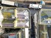
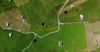
Drone land surveying is the process of capturing aerial data using unmanned aerial vehicles (UAVs) fitted with downward-facing cameras and sensors that record high-resolution images and detailed topographical data.
These drones are capable of evaluating huge plots of land at a speed much faster than any human could realistically achieve. Using the attached cameras and sensors, GPS-tracking, and sometimes LiDAR sensors, the drone systematically photographs the terrain from various angles to build a complete understanding of the land below.
Once the aerial data is collected, specialised software processes these images into detailed maps, orthomosaics (large, seamless images), and 3D models. This data is then analysed for applications ranging from land development and infrastructure planning to environmental studies and agricultural assessments.

Why Might I Need a Drone Land Survey?
Drone land surveys are useful for several different purposes, including:
- Site analysis, assessing the feasibility and design of projects.
- Detailed topographic mapping to provide precise elevation data.
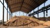
- Stockpile inventories - Volumetric surveys can be used to calculate stockpile and heap piles.
- Additionally, volumetric surveys can be used in the reverse, for excavation calculations and landfill, quarrying, and mining void calculations.
- Regular monitoring and tracking for construction developments.
- Inspecting assets and properties on commercial and residential sites.
- Providing virtual tours for real estate developers and potential property buyers.
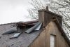
- Assessing structures for damage, ahead of insurance and claims assessments.
What Industries Benefit From Drone Land Surveys?
Drone land surveys are used across a wide number of industries, commonly including:
- Insurance
- Agriculture
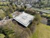
- Construction
- Landfill and Waste
- Property Management
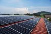
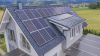
- Renewable Energy (such as solar and wind)
- Oil and Gas
- Electric Power (power line monitoring)
- Mining
- Environmental
- Disaster Management
- Engineering
What Technologies Do Drones Use for Surveying?
UAVs are so efficient because of the advanced technology they use; this transforms the way data is recorded and how it is presented during the reporting stage, leading to a greater understanding of the topography, and ultimately, more informed decisions. Some of the most effective technologies used include:
Photogrammetry
Photogrammetry involves capturing overlapping images from multiple angles to create accurate, scaled measurements, 3D models, or digital twins of topographical surfaces and physical structures. By stitching together aerial photos, photogrammetry software can produce detailed maps and models that capture elevation changes and surface features, commonly used for site planning, terrain analysis, and construction projects.
Orthomosaics
An orthomosaic is a high-resolution aerial image created by stitching together tens, hundreds, or even thousands of 2D photos taken by a drone, corrected for perspective to give a true-to-scale map; much like something you’d find on Google Earth or Google Maps. Unlike traditional aerial photos, orthomosaics remove distortions, making them ideal for precise measurements and analysis in surveying, agriculture, and infrastructure inspection.
Thermographic Imaging

Thermographic imaging, often simply known as thermal imaging, captures infrared radiation emitted by objects, allowing drones to detect temperature variations. This is particularly valuable for assessing energy performance within a property, asset, or wider land surface, where significant areas of heat loss are visible as bright colours, such as red or yellow, within the image.
LiDAR (Light Detection and Ranging)
LiDAR is a remote sensing method where drones use laser pulses to measure distances between the sensor and objects on the ground, capturing accurate elevation data. Although much less commonly used compared to the previous technologies, LiDAR can be especially useful in areas with dense vegetation, as it can “see” through tree canopies to map the ground below, creating detailed 3D models of the terrain.
What Are the Benefits of Drone Land Surveying?
Drones are highly beneficial for land surveys, with common advantages including:
-

Data can be collected significantly faster than traditional surveying methods.
-
Less equipment and manual labour are required, lowering overall project costs.
-
Accurate measurements and detailed images give a more precise account of land.
-
Surveys can be conducted even in hard-to-reach or hazardous areas.
-
Reduced impact on local ecosystems, and avoiding disturbance to wildlife.
-
Provides improved decision-making from comparative datasets provided.
-
Various options for data presentation, from thermographic to orthomosaic.
What Are the Limitations and Challenges of Drone Land Surveying?
Like any form of technology, there are still some limitations associated with drone land surveys, such as:
-

Dependency on good weather conditions. Drones can struggle in poor weather conditions, or give sub-optimal imagery and results.
-
Restrictions placed in certain areas may require authorisation to fly the drone.
-
Experienced pilots may be needed for trickier surveys.
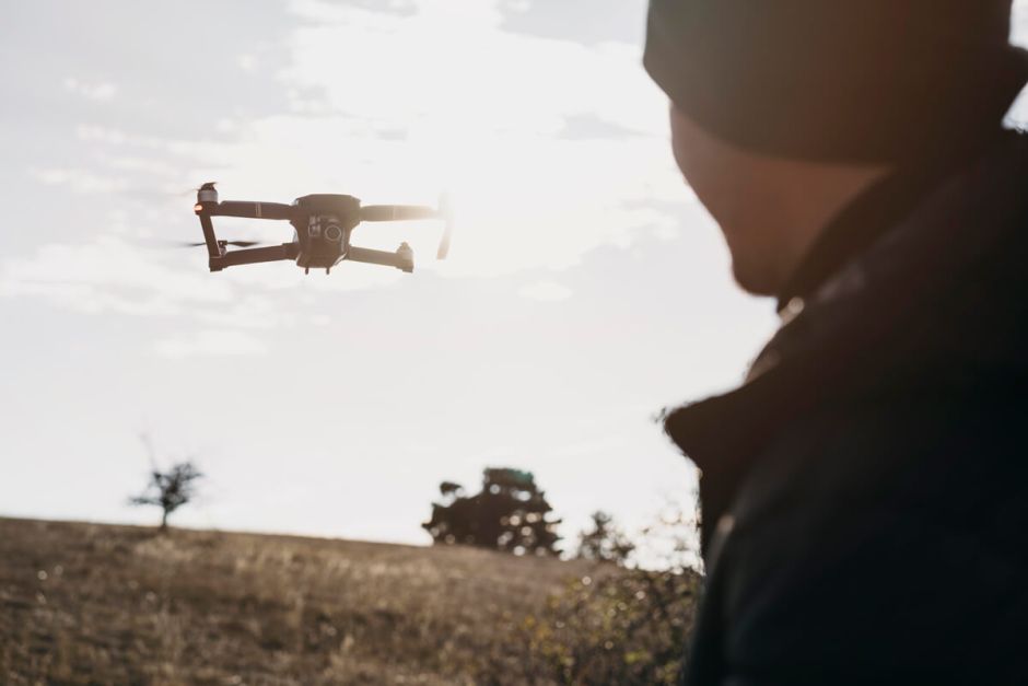
How Can I Find the Right Drone Pilot?
Finding a qualified, experienced drone operator is important for gaining the most accurate surveys and high-quality data reports, ensuring you get the most out of the service you’ve paid for. Skilled pilots are proficient not only in navigating complex environments but also in operating advanced drone technology, including photogrammetry and thermal imaging equipment, so you’ll want to find the right one!
To do so, review the pilot’s experience by familiarising yourself with the services they offer, and looking at examples of completed projects and client testimonials. Check for any certifications, such as the CAA Licence, that indicate safety and operational standards are met, as drone pilots will need these to legally operate. A reputable drone pilot will be more than happy to discuss what they offer and how this applies to your needs, so don’t be afraid to ask questions.
For Accurate Drone Land Surveys, Choose Full View
If you’re looking for a comprehensive land surveying and mapping service, look no further than Full View. Our experienced team know exactly what to look out for during each survey, and we offer a range of different methods to achieve this. Our honest reports are free from jargon, meaning you won’t be left trying to work out what they mean, and we deliver these in as little as 72 hours.
If you have any questions, or you’re wondering how to get started, please contact us today!